Schnebly Hill Road
Distance from the ’Y in Sedona (one way): 6.5 miles
Attractions: red rocks
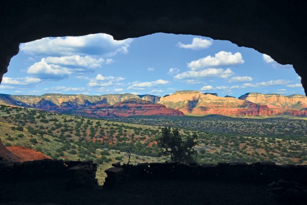
If you have a high-clearance vehicle or a four-wheel drive, jump in and make a beeline for Schnebly Hill Road. It might be Sedona’s bumpiest ride, and the driver is sure to get a workout maneuvering over jagged rocks, but you’ll be rewarded by views of rock formations you can only see from this road. For photography buffs, we recommend tackling this trip at sunrise. After you take a nap and download your photos, you’ll thank us.
From the ‘Y in Sedona, head south on State Route 179. Go past Tlaquepaque Arts & Crafts Village, and at the roundabout, head left on Schnebly Hill Road. The route passes the Sedona Creative Life Center and a trailhead before it turns to dirt, about one mile from the ’Y. And then you’ll want to hang on to your hats and glasses because things are going to get rough.
The road is relatively wide in the beginning as it slowly climbs to the top of the Mogollon Rim. If it’s a busy weekend, the number of personal vehicles and tour jeeps that you encounter might surprise you, so be careful on the road’s many blind curves. After driving two miles, look to your left for views of Mitten Ridge.
Munds Wagon Trail merges with Schnebly Hill Road numerous times along your drive – first at mile 3.3 – so watch out for hikers. We recommend pulling into the recently rebuilt parking ledge at mile 3.9 (on your right), crossing the road and taking a short hike to the Cow Pies formation. (Longtime readers will recognize it as a favorite spot for Sedona Monthly photo shoots.) The trail is flat, the black lava rocks are an interesting contrast with the red rocks and the views of Sedona from the Cow Pies are magnificent.
After you’ve stretched your legs, continue up to Merry Go Round rock, one mile from the Cow Pies. This is another stop that’s definitely worth exploring for the views and the chance to get up close and personal with the red rocks. Back in your car, pass through a gate (the forest service closes it in the winter due to snow), and suddenly the road narrows; the drop on your left isn’t for the faint of heart. The views, however, open up and stretch all the way to Mingus Mountain. You’re above the Cow Pies now, and it’s easy to see where the name comes from.
Look for Schnebly Hill Trail on your right, 5.5 miles from the start of your trip. Drive another half-mile, and you reach Casner Canyon on your right. Pause here and enjoy the smell of the trees, which are ablaze in color in the fall. Drive for another mile and you will reach the end of our journey: Schnebly Hill Vista. The wide parking area is a popular picture spot, especially for those of you contemplating the family Christmas card. Schnebly Hill Road continues another six miles through pine forests before it ends at Interstate 17. Continue on or head back to the ’Y for a bumpy but beautiful 13-mile round-trip.
Dry Creek Road
Distance from the ’Y in Sedona (one way): eight miles
Attractions: red rocks, hiking, wildlife, ruins, restaurants
A drive doesn’t necessarily need to be an all-day commitment to yield rewards. On sunny days, one of our favorite pastimes is heading out Dry Creek Road to hike or to dine at Enchantment Resort. If you’re visiting Sedona, you might not realize that some of the best views of the red rocks, especially the majestic Seven Canyons region, can be had along this route. For locals, you’ll definitely want to see Enchantment’s recent restaurant renovations. You don’t have to stay at the award-winning resort to enjoy a short staycation.
For photographers, the best time of the day for this drive is in the morning or evening. (We recommend Sunday mornings if you plan to stop at Enchantment; brunch at Che-Ah-Chi is not to be missed.) From the ’Y, head west on SR 89A for three miles. Turn right on Dry Creek Road, and within one mile, you will pass relatively close to Chimney Rock and the Lizard Head rock formation, both on your right. The speed limit on Dry Creek Road is 25 to 35, so you have time to slow down and take in your surroundings. The road twists and undulates with all of the Seven Canyons area spread out in front of you. Two miles after turning onto Dry Creek Road, Vultee Arch Road will be on the right. This dirt route is truly only suitable for high-clearance vehicles (four-wheel-drive trucks are best), but it is the gateway to some of our favorite hikes, including Secret Canyon.
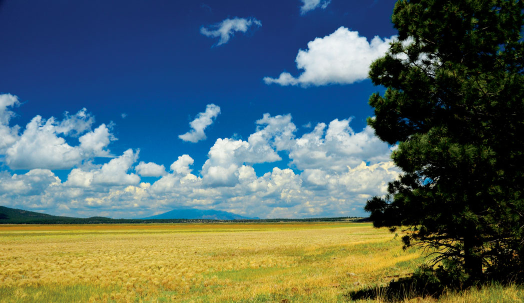
Continue on Dry Creek Road, and keep an eye out for wildlife, which we frequently spot in this area. We’ve witnessed bobcats, deer and javelina crossing the road. Dry Creek ends at a T-intersection six miles from the ’Y. Turn left toward Enchantment Resort (turning right takes you to the private Seven Canyons golf resort). Drive for one mile, and make a right on Boynton Canyon Road. You’re engulfed by red rocks now, and shortly after you make your turn, the Boynton Canyon/Dead Man’s Pass Trailhead is located on your right. The road dead-ends at Enchantment Resort. If you are stopping for a meal, tell the attendant at the gate, and he or she will let you onto the grounds (reservations are recommended). During our visit, we had a leisurely brunch, marveling at the view from the restaurant’s enormous windows. Yes, we live in Sedona and yes, we were still in Red Rock Country, but the peace and quiet at Enchantment makes you feel worlds away.