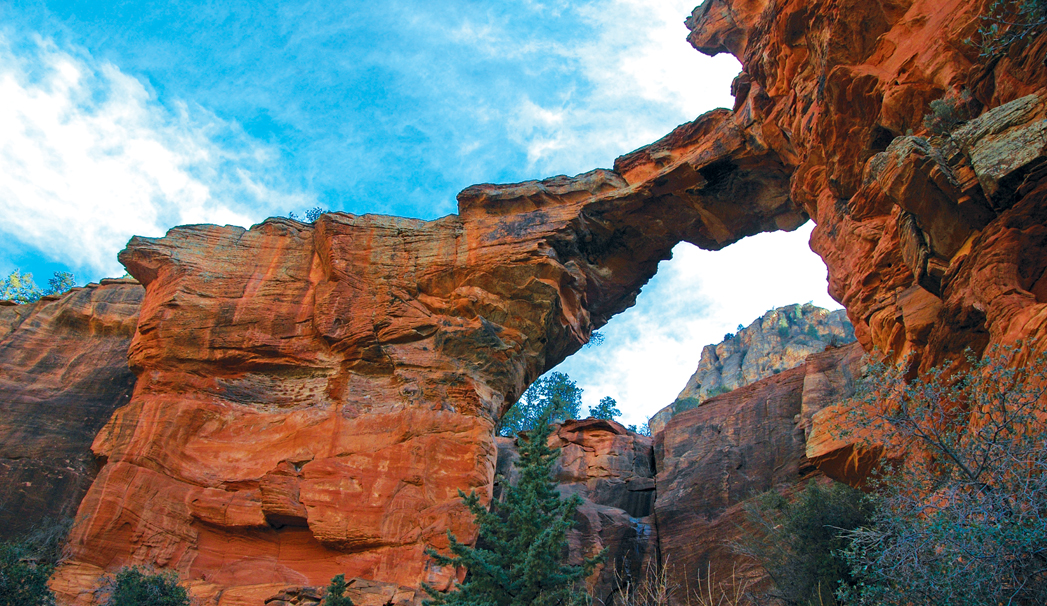
The name of Sedona’s largest sandstone arch, Devil’s Bridge, might sound sinister, but there’s no need to start reciting your Hail Marys just yet. The short, 0.9-mile trail that leads to the top of the arch is absolutely divine, which might be the reason why it attracts so many hikers each year. The road that leads to the Devil’s Bridge Trailhead, FR152 or Vultee Arch Road, is actually more treacherous than the trail itself. We definitely recommend a high-clearance vehicle to get to this trailhead, and four-wheel drive wouldn’t hurt either. For those driving compact cars, take heart. It’s an easy 1.3-mile walk from the paved parking lot to the trailhead.
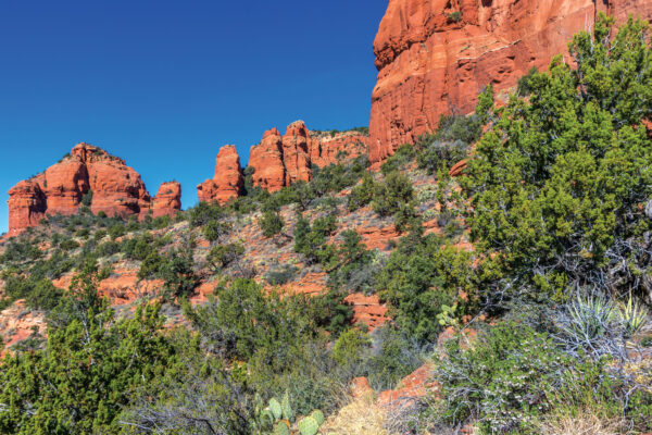
When you start hiking to Devil’s Bridge, you get the feeling you’re hiking into a canyon because the red rock cliffs tower above you, but you’re not. The trail climbs gently in the beginning with broom snakeweed, juniper trees, manzanita bushes, prickly pear cactuses and banana yuccas growing on either side. After hiking 0.41 mile, you’ll reach a trail registry on your right. Make sure you sign in. Look across from the registry at the cliffs. The black patina, or “desert varnish,” on the red rocks is mineral (manganese oxides, iron and silica) deposits.
About a half-mile into your hike, the trail begins to climb more steeply, and it becomes rocky. At 0.68 mile, the route narrows dramatically. You’ll reach a fork in the trail 0.71 mile from the trailhead – stay to the left. Walk another couple hundred feet and then climb up the rock staircase on your right. The staircase levels out on a rock shelf that offers amazing views of the Seven Canyons area. Keep hiking, duck under a tree at 0.84 mile, and suddenly the bridge appears parallel to you on the left. The trail continues out onto the bridge, though a sign at the trailhead posted by the forest service warns against walking across the bridge due to the inherent instability of sandstone arches. Proceed with caution and at your own risk.
Walk back down the staircase and instead of turning left to head back to your car, turn right and follow the short path that leads to the base of the arch. You’ll have to scramble over some boulders to get to it, but you’re rewarded with a view of the bridge’s underside, 50 feet above you. It’s all downhill back to the trailhead, and our entire hike clocked in at 1.89 miles round trip. Add 2.6 miles to that total if you walk in from the road.