Back in the day, accessing the Vultee Arch Trailhead wasn’t nearly as challenging as it is now. The only way to reach it today is with a high-clearance four-wheel drive vehicle (yes, you need both high clearance and four-wheel drive and yes, that was how we reached the trailhead), via connector trails or by walking the dusty 4-plus-mile Vultee Arch Road (FR 152). The upside: Even during busy spring break, we practically had the entire trail to ourselves. If you want a backcountry experience, here you go.
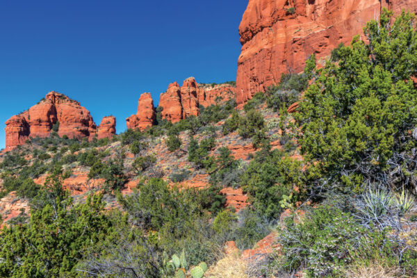
Within a couple hundred feet of starting your hike, you enter Wilderness Area. The trail is flat with a tangle of manzanita bushes growing on both sides. (During our hike, the manzanita was in bloom, so we were surrounded by tiny pink flowers that smelled like honey.) Vultee Arch Trail runs parallel to a streambed that is dry much of the year, though that wasn’t the case on our hike. It was a treat to look over our shoulders at nearby Wilson Mountain, which still had some snow on the top, and see wet patches where the snowmelt was making its journey to Dry Creek and its tributaries. We actually counted 11 stream crossings on this trail, but they were all shallow and easy to navigate. The trail remains relatively flat throughout the hike, meandering through a forest of Ponderosa pines and alligator bark junipers.
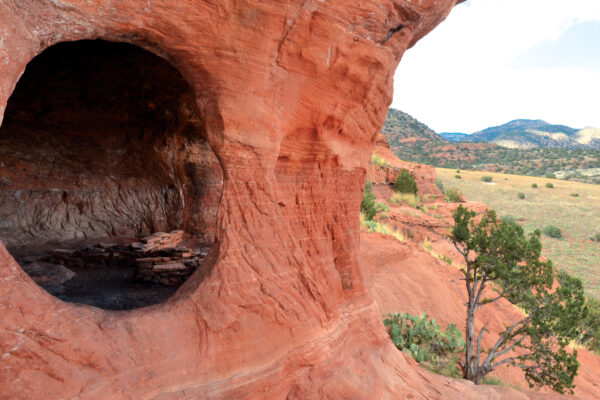
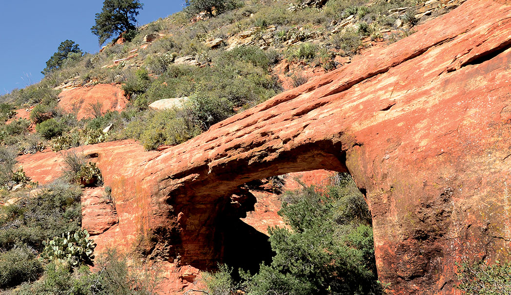
After hiking 1.72 miles, we came to the junction of Vultee Arch and Sterling Pass trails. Continue on Vultee Arch and in just a few steps, look to the left to see the trail’s namesake arch in the red rocks and forest above you. This is the prettiest part of the trail with plenty of picnic spots. Climb the red rock knoll to your right to find the plaque memorializing Gerard “Jerry” Vultee and his wife, Sylvia. The pioneer aviators died in a plane crash near the site in 1938. The trail officially ends here, though it’s possible to continue for another quarter of a mile to reach the arch and even walk across it (not for the faint of heart or those with a fear of heights). The trail leading to the arch is very steep and rocky – hike it at your own risk. Return the way you came for a 3.5- to 4-mile round-trip (depending on your thirst for adventure) journey.