Denise and Larry Garnello, owners of Magic Clothing in Sedona and Crystal Magic in Sedona and Flagstaff
What is your favorite hike and why?
Sugarloaf Summit because it’s a 5-minute walk to the trail from our house, and it has fantastic views all around.
Who do you hike with?
Each other and our dogs or our friends.
How long have you lived in Sedona?
Twenty years.
When did you first hike here and do you remember the trail?
We first hiked here in May 1997. We hiked Sugarloaf Summit with the dog and the kids the first morning we lived here. We were still unpacking from our move.
Where else have you hiked?
Yosemite, Yellowstone, Zion, Bryce Canyon, Grand Tetons, Mt. Rainier, Mt. Hood, Mount St. Helens, Ouray, Durango, Maui, Kauai, etc.
Finish this sentence: When we go hiking, we don’t leave home without…
The dogs.
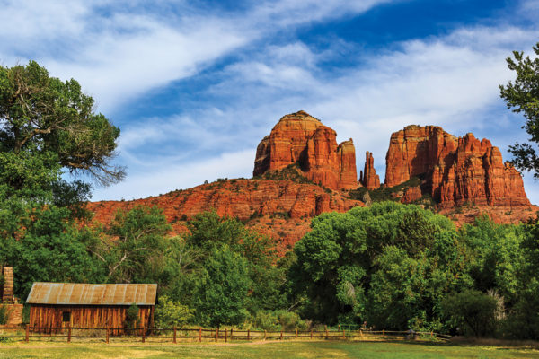
Sugarloaf Summit
Denise and Larry are right: This easy-to-access hike provides some of the best views of Sedona and the surrounding red rocks. Sugarloaf is the little red rock mound at the base of Capitol Butte; it’s visible from nearly any point in West Sedona. The trail begins off Buena Vista Drive. Start out hiking Teacup Trail until you reach the intersection of Teacup and Sugarloaf Loop. The loop stays relatively flat until you reach the spur for Sugarloaf Summit, which leads to the top of its namesake. The climb is short and not exceptionally steep, but it will get your heart pumping, making it a favorite evening workout for locals. When you reach the top, you will be rewarded with views of Airport Mesa, Courthouse Butte, Bell Rock and the tip top of Cathedral Rock. Looking southwest, you will see Cottonwood, Mingus Mountain and Jerome. From this vantage point, West Sedona, spread out below you, looks like a diorama of a town.
Return from the summit the way you came and continue hiking the flat loop as it winds its way through juniper trees and prickly pear cactus.
Gary and Holly Stedman, owners of Canyon Outfitters in Sedona
What is your favorite hike and why?
West Fork. Back in the late ’80s, parking was limited to the wide shoulders between the driveways of private residences. Our now-long-out-of-print guide book by Stewart Aitchison instructed visitors to “walk down the blocked-off road past the blackberry bushes, scarlet sumac, wild grape, the tall white fir on your left, the Douglas fir on your right, around the bend where an old Arizona sycamore shades the path, and down to the creek . . .” West Fork is home to an abundant variety of trees, plants, flowers, animals – many of which are usually geographically separated. The sound of running water is a frequent reminder that you are in a place so uniquely different from the surrounding high desert. Surrounding the creek is a wonderful variety of little recesses or rocky overhangs – great hangouts for a snack or a nap. You are enticed to explore further and further along and around each bend in the creek.
What is your favorite time of the year to hike the trail?
Surprisingly one of our favorite times of the year is winter. No crowds and no foliage to obscure the steep red wall cliffs. After it snows, it’s a wonderland, though the stream crossings can be icy, so you should always take hiking staffs.
When did you first hike here and do you remember the trail?
The West Fork hike began it all for us. We were never the same. We knew we were hooked when we began our exit plans from our lives and jobs in Michigan. That was 28 years ago, and we never looked back. That trail and many others lured us to Sedona in 1993 where we opened Canyon Outfitters as the original hiking, camping, backpacking and climbing store in the area.
Where else have you hiked?
We have fond memories of trekking in the Grand Canyon and the Sierras. Holly led several month-long private expeditions to the Arctic National Wildlife Refuge and Banks Island in Northwest Territory, Canada, photographing grizzly bear, wolves, arctic fox, musk ox and the annual caribou migration.
Finish this sentence: When we go hiking, we don’t leave home without…
Telling someone who cares about [our] plans and when [we are] expected to return. And [we] never deviate from those plans without telling them.
West Fork
It’s hard to improve upon Gary and Holly’s ode to the landmark trail. We will tell you that it starts at the Call of the Canyon/West Fork Day Use Area in Oak Creek Canyon, and hiking the most popular portion of the trail is a 7-mile round trip, though it’s possible to hike 14 miles (one way) to the top of the Mogollon Rim. West Fork is a tributary of Oak Creek Canyon. If you hike the entire 7 miles, you will cross the creek a whopping 26 times, but those crossings are usually quite shallow with strategically placed rocks forming footpaths.
Gary and Holly aren’t the only ones in love with West Fork. It’s one of Sedona’s most popular hiking trails, especially in the summer (when people like to swim in the creek) and the fall (when amateur and professional photographers descend to photograph the changing leaves). Depending on the time of year, you can expect long lines of cars at the entrance and a crowded trail, but even that doesn’t detract from the canyon’s majesty.