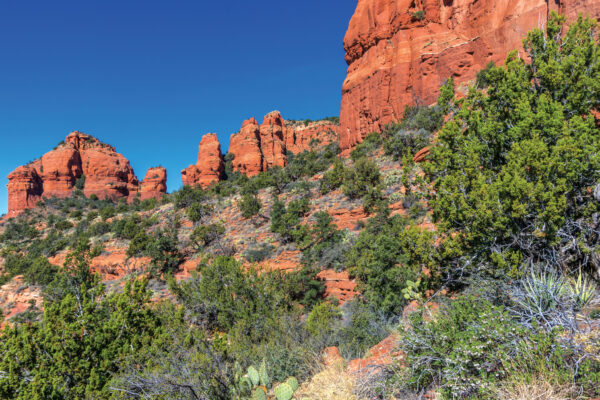
Were you disappointed (but obviously not surprised) that The Hangover Part III wasn’t worth the price of admission? We guarantee you won’t feel that way about the new Hangover Trail that traverses Mitten Ridge. For the past year or so, Sedona Monthly has been on a hot streak when it comes to exploring new trails: We’ve fallen in love with hiking in Red Rock Country all over again. We thought the pinnacle of these new gems was the Hiline Trail, but the Hangover gives Hiline a run for its money.
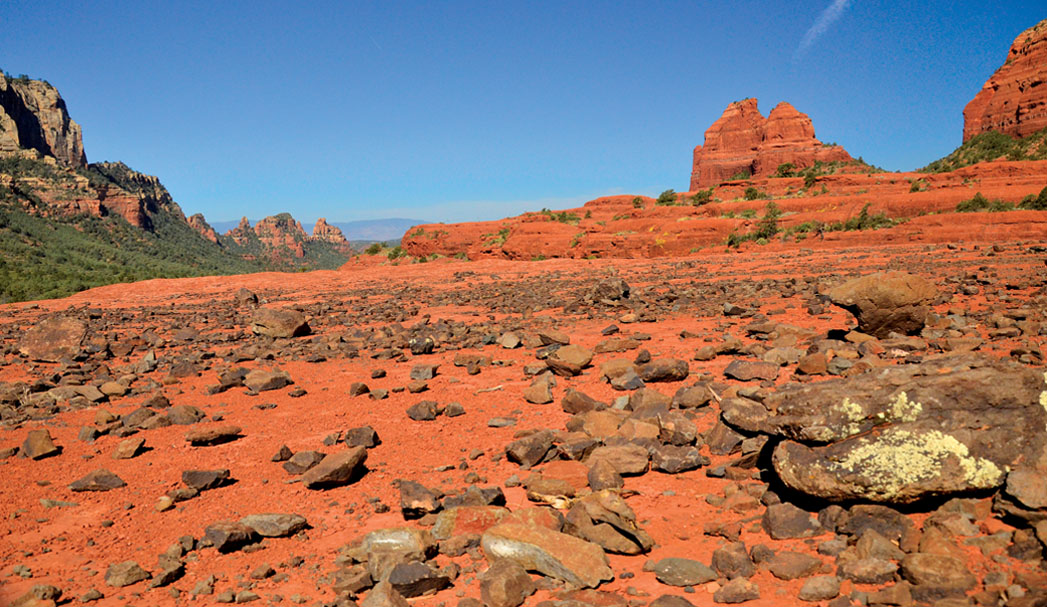
Just like many of the newer trails in the Coconino National Forest, the Hangover has long been a favorite with mountain bikers. There are numerous ways to hike this trail, but we started on the Cow Pies Trail along Schnebly Hill Road. (You will need, at minimum, a high-clearance vehicle to drive up this road.) After only 0.16 mile, you will reach the Cow Pies formation, a Moon-like landscape strewn with black lava rocks and shockingly green lizards. Continue on, and you’ll reach the sign for the Hangover after hiking 0.56 mile. Follow the signs and the white markers painted on the slick rock. The trail wanders along a narrow ledge slightly above the Cow Pies, making us feel like we were hiking on the rim of a giant bowl. You’ll walk past some interesting boulders before making the short but steep climb to the Mitten Ridge saddle at 1.45 miles.
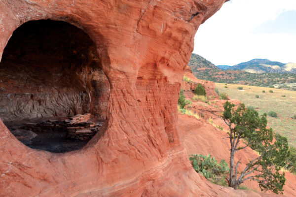
From the saddle, you’ll be able to gaze into Oak Creek Canyon, an awesome sight. Follow the markers as the trail leads you down the other side of the ridge. After you’ve been hiking 1.87 miles, you’ll understand the trail’s namesake. For several hundred yards the extremely narrow trail hugs a rock face that curls up like a wave: the hangover. In some spots, the mud on the walls peels away like tree bark, and in other areas there are holes in the rock similar to shallow caves. It all adds up to a relatively unique landscape, but be mindful of the drop-off on your right.
At the 2.6-mile point, you’ll round the toe of the ridge for views of Uptown and West Sedona. Continue further and you’ll have a peek at Cathedral Rock before the trail dramatically descends a slick-rock shelf. Watch your footing here – it’s steep enough that we had to scoot on our seats a few times. The trail offers up wonderful views of the Phoenix and Turkey rock formations before joining Munds Wagon Trail. By this point, you’ve been hiking 4.07 miles (if you’re like us, you’ll definitely be feeling it). Hike Munds Wagon uphill until it crosses Schnebly Hill Road. Instead of crossing the road, turn left and hike less than a quarter of a mile up Schnebly Hill. You’ll return to your parking spot for a 5.18-mile round-trip hike that’s a blockbuster in our book.