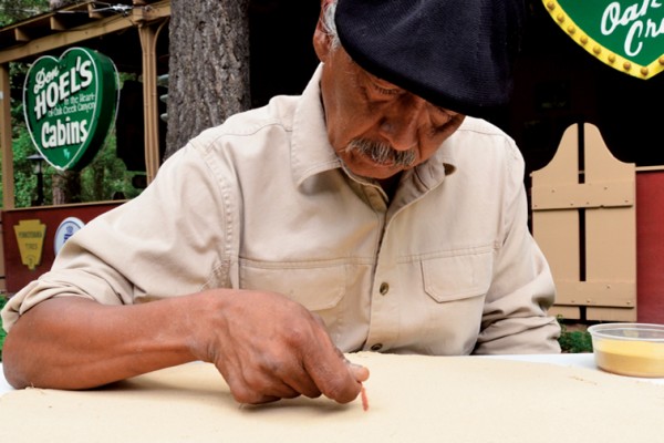
This month, Sedona Monthly celebrates 10 years of publishing Arizona’s magazine with the great view. Hooray for us! Hiking is one of the reasons we moved to Sedona, and since our first issue in March 2003, we have written about our favorite trails, beginning with Palatki Heritage Site. We’ve covered a lot of ground in 10 years, so we recently spent time poring over our back issues to choose our 10 favorite hikes. I won’t lie – arguments ensued. It wasn’t an easy task, but we finally came to a consensus about the trails that offer the best experiences for everyone whether a serious hiker, a picnicker, a photographer or an Arizona native who has been there and done that. Some of our favorites won’t surprise you (ahem, West Fork) but others will pique your inner explorer (Robbers Roost).
Eager to lace up your boots and give these trails a try? We recommend heading to The Hike House (431 SR 179 at Hozho Center; 928-282-5820) first. The hiking experts there will provide you with detailed maps and directions for any of the trails listed (with the exception of The Wave – you’ll need a permit from the Bureau of Land Management to hike that one). Be safe, have fun and happy trails!
Bright Angel
Round-Trip Distance: 18.5 miles
Published in Sedona Monthly: November 2009
The South Kaibab Trail might be the shorter route to the bottom of the Grand Canyon, but we love Bright Angel Trail for its changing ecological zones, gurgling streams, classic views and slightly more knee-friendly incline. Depending on the season (we hiked in November after a big snowstorm), Garden Creek provides small waterfalls and a pleasant soundtrack to your journey. The trail traverses slick rock shelves, narrow ravines and a series of switchbacks called the Devil’s Corkscrew (not nearly as intimidating as it sounds). Indian Gardens, complete with campground, ranger station, restrooms, water and picnic tables, is the halfway point along the trail. For the fit hiker, it’s possible to hike to and from Indian Gardens in a single day, but we would never recommend a round-trip journey to the Colorado River at the bottom of the Grand Canyon as a day hike. (It took us more than eight hours to hike from the bottom of the canyon to the rim via Bright Angel Trail.) To tackle the entire Bright Angel Trail, secure a backpacking permit by visiting www.nps.gov/grca and start training.
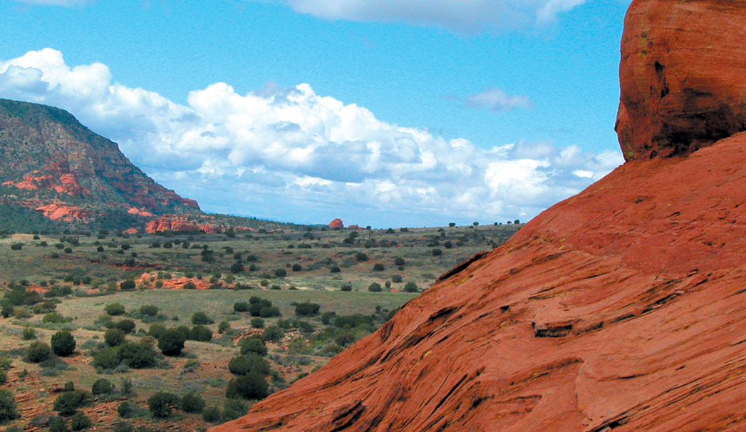
Cathedral Rock
Round-Trip Distance: 1.7 miles
Published in Sedona Monthly: March 2004 and November 2010
Even the most seasoned hiker has to admit that hiking to the saddle of Cathedral Rock isn’t a walk in the park, but its short distance makes it completely doable. We’ve dragged everyone from toddlers to two Parisian city slickers to a Hollywood club kid to the top, and they all agreed it was worth the effort. The views – not to mention the peace and quiet – you’ll encounter at the saddle are bar none. The trail begins climbing as soon as you leave the parking lot. Be prepared to shimmy and wiggle through cracks and crevices in your quest for the saddle. (It isn’t possible – as far as we know – to hike to the summit of Cathedral; you’ll need a rope and harness for that.) There are plenty of places to stop and catch your breath along the way, and the views just get better and better. You’ll spy Courthouse Butte, Bell Rock, the Chapel of the Holy Cross, Lee Mountain and the Rabbit Ears. Once you reach the saddle, you’ll see Oak Creek far below and Mingus Mountain and the town of Jerome off in the distance. Spend some time exploring the saddle and marveling at the formation’s graceful dome and spires towering above you.
Coffee Pot Rock
Round-Trip Distance: Two miles
Published in Sedona Monthly: December 2006
Every now and then, we stumble upon a trail that surprises us, and the easy route that leads to the base of Coffee Pot Rock was one of those. It’s a perfect hike to share with out-of-town guests: It’s close to town, short and flat, and provides up-close views of the red rocks as well as wide-sweeping panoramas of our lovely little town. The hike begins at Sugarloaf Trailhead. Take Teacup Trail and hike past the junctions of Sugarloaf Loop and Sugarloaf Summit. On your left, look for a large bush encircled by rocks; turn here and you’re on your way to Coffee Pot Rock. The trail is easy to spot, and the wide pathway gently makes its way to the base of Thunder Mountain and Teacup Rock. The trail ends under Coffee Pot’s “spout.” The flat, wide slick rock ledges in this area allow for plenty of time to sit and soak up the views of Airport Mesa, Cathedral Rock, Soldier Pass and a good portion of West Sedona.
Courthouse Butte Loop
Round-Trip Distance: 4.5 miles
Published in Sedona Monthly: September 2005 and October 2010
The Village of Oak Creek boasts some of the most recognizable rock formations in all of Sedona, and you get a glimpse of all of them along this easy-to-moderate loop hike. Start hiking Bell Rock Pathway from the trailhead near Bell Rock Boulevard, and immediately you are treated to grandiose views of Castle Rock, Bell Rock and Courthouse Butte. Courthouse Butte Loop begins about a half-mile into your hike – look for the signed trail on the right. The loop circles Courthouse Butte and winds its way through chaparral, a slick rock wash that usually has puddles filled with tadpoles and frogs, and ledges with stellar views of the Rabbit Ears formation. Watch raptors and ravens kiting above you and settling in nests on Courthouse Butte. About halfway through your hike, the views extend beyond Courthouse Butte and Lee Mountain and stretch all the way to Capitol Butte, Cockscomb and even Robbers Roost. For an interesting and fun side hike, make the quick jaunt up Baby Bell, which you’ll find near the junction of Courthouse Butte Loop and Llama Trail. The loop eventually meets up with crowded Bell Rock Pathway again, and you’ll be dodging mountain bikers and tourists with Red Rock Fever (as well as hearing traffic from nearby SR 179), but it’s completely worth it.