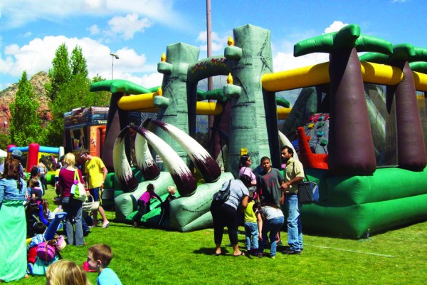
Last fall, Sedona Monthly hiked the rings of Saturn. It took us years to get there, and the permit process was painful, but the payoff was absolutely worth it. Our group included three of the 20 people who wandered through a maze of psychedelic colors in a gritty wind, snapping photos and observing the hushed silence. We heard German and French being spoken. We met a couple from Indiana. We didn’t cross paths with anyone else from Arizona. Shooting stars were involved. Everyone was awestruck.
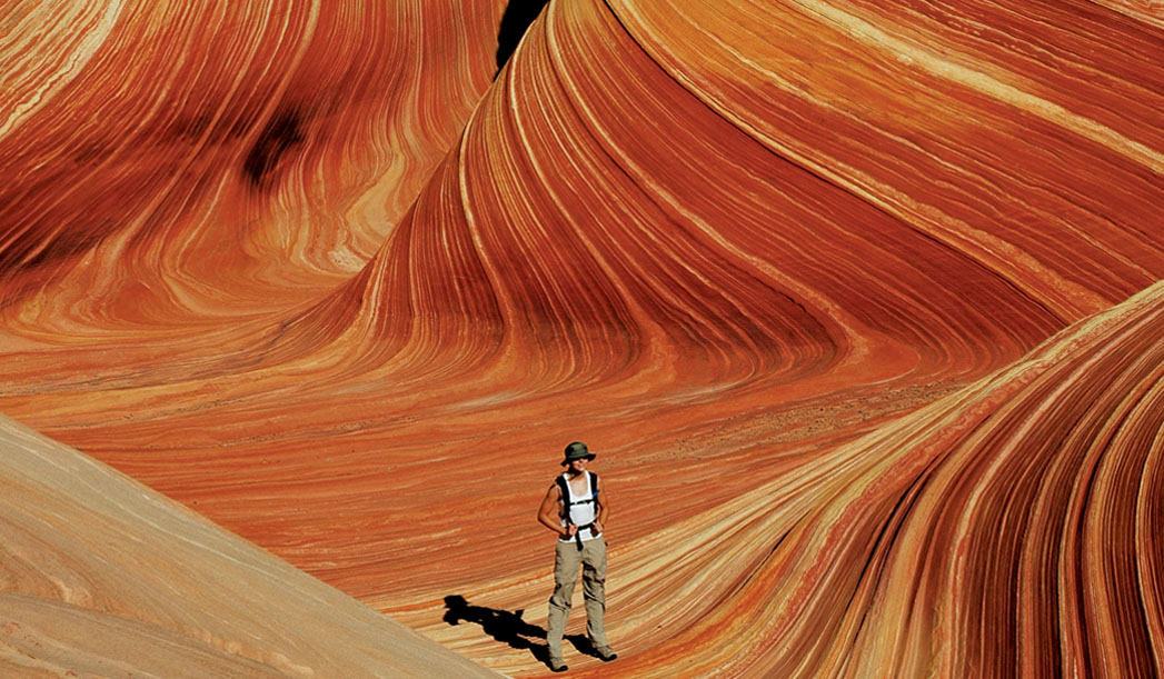
Okay, so we didn’t really hike the rings of Saturn, but after spending a full day at The Wave in Coyote Buttes North, part of the 280,000-acre Vermillion Cliffs National Monument on the border of Arizona and Utah, that struck all of us as the most apt description. Everyone has seen photos of The Wave, but few people have any idea where it’s located. (It turns out that’s exactly what the Bureau of Land Management wants.) We first heard about the Navajo sandstone formation and the infamous permit process when we explored the slot canyons in northern Arizona in 2007. Photos that seemed to depict a giant skate park crafted out of taffy or raspberry cake frosting captivated us. It took us more than two years to actually get to The Wave – we had one near miss back in spring 2008 when we realized we had obtained a permit for Coyote Buttes South, which does not include The Wave. Disappointment ensued, yet we refused to give up, and our persistence paid off.
The trailhead for The Wave is a solid four-hour drive from Sedona through Page, past Lake Powell, into Utah and then eight miles on a dirt road. The road is compact and suitable for most cars, but if it has rained recently, watch out – the road will be impassable without a four-wheel drive. Lucky for us, it had been dry for weeks. We opted to drive out a day early and camp at Stateline Campground, which is located one mile south of the Wire Pass trailhead and the beginning of our hike. There is absolutely no camping at The Wave. There are only four campsites at Stateline, but it seemed like most people in the area were camping in the large dirt parking lot at the Wire Pass trailhead (multiple hikes begin at this trailhead, including the popular, multi-day Paria Canyon – another trip on our live’s to-do list), so we were able to secure a site even after arriving at 5 p.m. There is no fee for the campground, and it had toilets, picnic tables and fire pits but no water. Just before turning in for the night (and after consuming way too much junk food), the biggest, brightest shooting star any of us had seen arced across the night sky and broke up into a million sparkling pieces as it entered earth’s atmosphere. We decided it was a good omen.
We were up bright and early on the permitted Sunday of our hike, dodging jackrabbits and armed with cameras, snacks and a map that made us realize this wasn’t going to be like hiking to Havasupai or into the Grand Canyon. Where we were going, there was no trail. Literally.
The Wave is a very fragile environment, which is why you need a permit to visit, why only 20 people per day are issued permits and why you don’t receive directions to the formation until after you’ve been issued a permit. The map itself is a series of landmarks to watch out for as you make your way 2.5 to three miles to your destination. It’s easy to get lost even with a map, especially considering anyone you might encounter in the area has the same instructions you have. Our best recommendation: If you have a handheld Global Positioning System (GPS), bring it with you and input the longitude and latitude coordinates that accompany your map. It will help keep you on the right track. (Naturally, there is no cell-phone service in this area.) No matter what time of year, don’t leave home without a headlamp or flashlight. Originally, we planned to stay at The Wave until sunset and hike back in the evening. With the lack of a hiking trail, we were all glad when we made it back to the car while it was still light outside.
Though we consider ourselves experienced hikers, the trek to The Wave challenged not only our navigation skills but also our endurance. You’ll make several climbs and plod through more sand than we’ve seen since we lived near the Pacific Ocean’s waves. In the last quarter-mile before you reach The Wave, the route takes you up and over a large sand dune. Rest assured you’ll be out of breath by the time you reach the top. Fortunately, the landscape lends itself to plenty of photo opportunities and chances to catch your breath. A local photographer told us that the colors in and around The Wave were like nothing he’d ever seen. But we’re a cynical bunch, and we were confident The Wave and its surrounding formations would resemble the red rocks of Sedona and the Grand Canyon. Let’s be clear: We were wrong. The rising sun revealed shades of yellow, gold, peach, orange, red, pink and even green and blue; and that was before we’d even reached the main event. Some formations made us think of uneven stacks of pancakes (for whatever reason, the food analogies were alive and well on this adventure) while others resembled rough-hewn pyramids built by ancient cultures. Even the sand seemed unique in this area, and we kept wandering through spots where the soil had formed into millions of tiny sandstone pearls. The landscape was nearly void of plant life save for some shrubs and gnarled trees, bent into odd shapes by the wind that plagued us our entire visit…the same wind responsible for creating The Wave.